
A long time ago I wrote a blog post about how to add location data to photos using a tool called GPSLogger to record your location, as well as GeoSetter to take that data and apply it to photos. It’s been a long time since that blog post, and I was looking to do the same thing recently. A couple of phones later I no longer had GPSLogger (and forgot to check my blog to remember what I used to use), but since I was using Google Fit to track my location, I figured it would be easy to use that data to do the same thing. And it was! Continue reading to see how…
The first thing I had to do was to get the location data from Google. There is no direct way to export a workout from Google Fit, so that wouldn’t work. However, Google makes it easy to get your data using Google Takeout. Simply select fit and the data you want to get : you’ll want the “Activities” at least since that’s where the location data is located. Submit the request and a short time later you’ll be able to download the data.
After unzipping and finding the Activities folder, you can go to the activity you recorded, such as a hike, and find the right TCX file. I had a problem using the TCX file format with GeoSetter, but I found a way around that: I converted the TCX files to GPX using the handy converter at GPS Visualizer. It can even merge multiple TCX files into one.
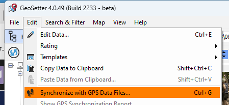
Once I had converted the file, I used GeoSetter to sync the data by clicking on “Edit”, then “Synchronize with GPS Data Files…” after selecting the appropriate photos:
Once the proper data is applied to your photos, just save and you are done!
One final note: in order to get support for CR3 files I had to download the beta of GeoSetter here: https://geosetter.de/geosetter_beta.exe. It’s beta but I’ve had no problems with it.
Now you can track your photo walks with Google Fit AND make it easy to add location data at the same time!